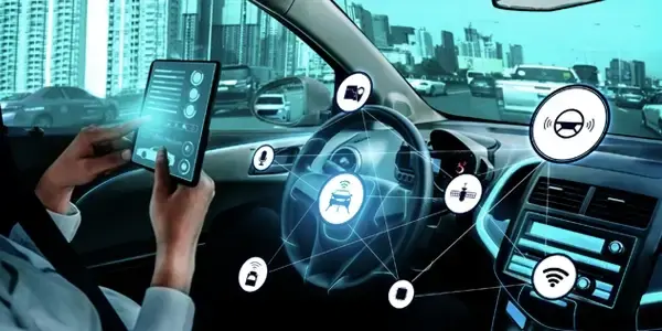
LiDAR (light detecting and ranging) utilizes laser pulses for measuring and estimating distance between objects. It has made autonomous vehicles safe through continuous collection of data from the area surrounding the vehicles 24 x 7. LiDAR is also used in the automobile sector for seeing obstacles including other vehicles, pedestrians, and buildings. AI development has also led to increasing the efficiency of LiDAR.
15+
Years of Experience
1500+
Annotators Working 24x7
100%
Data Security
99%
Accuracy Achieved
24X7
Availability
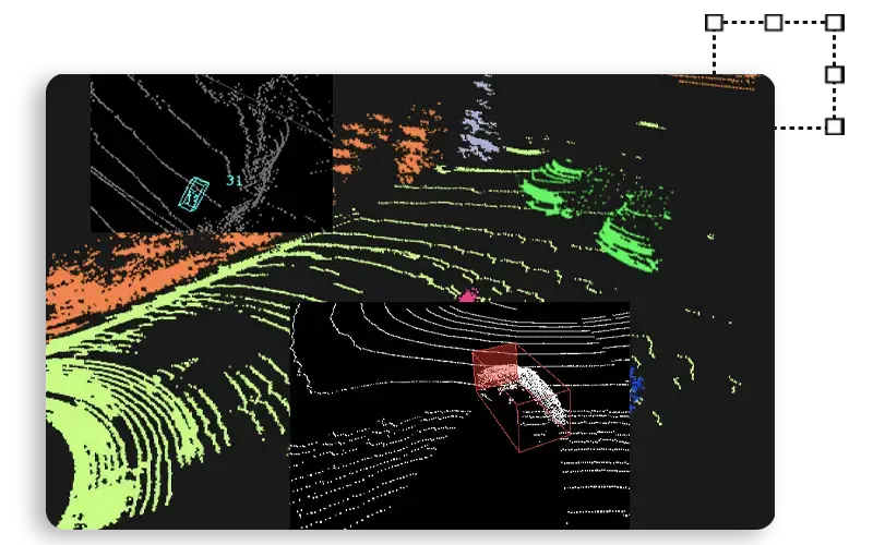
3D Point Cloud Annotation Services
We help you visualize an object to better detect and classify for getting accurate dimensions.
3D Point Annotation for All LiDARs
3D Point Cloud Annotation can sense objects which are around 1 cm with 3D boxes with definite class annotation. It is mainly used for autonomous vehicles for identifying objects in either environments - indoor and outdoor.. It can also detect the object’s motion in a video.
Classify Objects and Detect Lanes
Through our services we assist in distinguishing various kinds of lanes. This helps in distinguishing various types of lanes in point cloud map to annotate the roads for safe driving of autonomous vehicles suitable for every object in 3D orientation with a class at high-level of accuracy.
Object Detection with 3D Boxes
3D boxes for better object detection and tracking involves single points with quality for obtaining details like size, location, speed, pitch with class. The most advanced 3D point cloud labeling tool is used for supporting all types of objects including other objects of interest dimension including designated pedestrians and cycling drivable designated zones on the street.
Use Cases
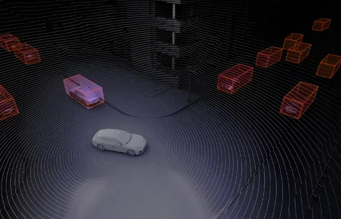
Self-Driving Cars
Properly annotated AI training data is used for enabling quick deployment of AI in self-driving vehicles for detecting obstances on the road, traffic signals, and other automobiles.

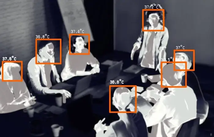
Security
The use of AI in security cameras and drones can be utilized to detect and view the object depth including humans, automobiles, animals, and property by utilizing training data.

Agriculture
Obtain a topographical view of land to analyze and make a plan of action for maximizing gains through implementation of AI using annotated training data.
Frequently Asked Questions
There are four ways in which LiDAR Annotation works:
1. Laser: This sends infrared or UV light in the path of objects for measuring distance.
2. Scanner: This regulates the LiDAR system by controlling speed with which the laser scans objects and estimates the optimal distance the laser can reach.
3. Sensor: It calculates the time taken for a pulse to reach an object and travel back. By carrying out this exercise, the distance between the LiDAR system and its target object is calculated.
4. GPS: The position of the LiDAR system is tracked for ensuring the accuracy of the distance calculated by the sensor.
Why should you outsource to Anolytics?
You can trust us in offering quality of LiDAR Annotation work because we offer:

Quality With Accuracy
Get the best-in-class quality services with highest accuracy level delivering an excellence in image annotation through multiple stages of auditing and reviewing of labeled data.

Security With Privacy
We are certified with SOC 2 TYPE 1 Company for maintaining the high standards of data security with privacy while working with our clients to ensure their confidentiality.

Fully Scalable Service
Working with hundreds of workforce to annotate pictures as per the demand providing a completely scalable solution with turnaround time to meet the different client’ needs.

Cost-effective Pricing
Image annotation outsourcing to us means our clients get a cost-effective data labeling service helping them to minimize the cost of their project with best efficiency.
Get in Touch with us
 USA Office
16 Horseshoe Ln, Levittown, NY 11756, United States
 India Office
A-83, Sector-2, Noida, Uttar Pradesh 201301
 Call us on.
+1 516-342-5749
 Schedule a Call
with our Enterprise Specialist